
CWMN Water Data and Dialogue Event Recap
On June 19th the Drinking Water and Watershed Protection Program hosted a “Water Data and Dialogue” symposium at Tigh-Na-Mara in Parksville. This annual event invites water stewards, members of the public, and partner organizations to learn about the results of data gathered from the Community Watershed Monitoring Network (CWMN) and highlight regional contributions to watershed health across the RDN. This year’s session featured four guest speakers to extend information sharing and connect the community to additional monitoring and stewardship initiatives. Invited presentations included:
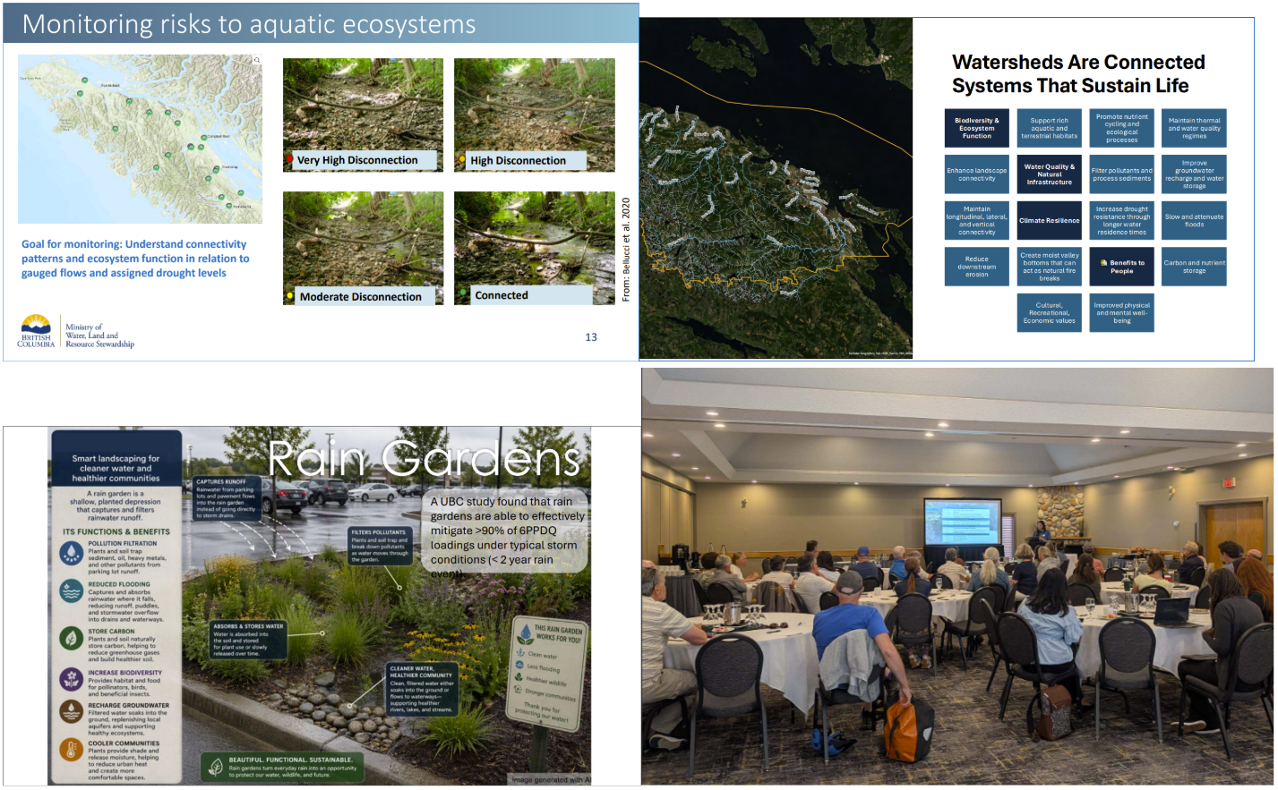
- Ally Wall from the British Columbia Conservation Foundation presented about the Flow Monitoring Network
- Elodie Roger from Origin Environmental presented on Low Tech Restoration Techniques
- Charlotte Billingham from the Ministry of Water Land and Resource Stewardship presented on the Provincial Drought Monitoring Pilot Project
- Haley Tomlin from the British Columbia Conservation Foundation spoke to Green Infrastructure Solutions for Storm Water Capture
Each presentation highlighted contributions of community stewards and innovative solutions working in combination to help improve, maintain and monitor watershed health.
The RDN's CWMN is one of the key networks gathering data to drive regional action and relies on trained volunteers who dedicate their time during summer low flows and the fall flush to sample surface water quality. Water quality parameters that are tested within the network are: water temperature, dissolved oxygen, turbidity and specific conductance. After the data is analyzed, points that exceed Provincial guidelines are flagged and reported in exceedance maps that show the location and severity of exceedances across summer and fall sampling periods. The results highlighted in this session covered 69 sample sites across 44 streams.
In addition to presentations and sharing monitoring results, participants were invited to engage in interactive discussion focused on the development and expansion of stewardship support tools, with the emphasis on gathering feedback to construct a new mapping tool to support data sharing and restoration prioritization. As a hub gathering information from regional partners, the DWWP is well positioned to provide data in accessible formats that can support various groups in their monitoring, planning, restoration and watershed protection efforts. The session introduced several options for
different mapping platforms and led directed conversations on what should be included in the mapping tool, the ways in which the tool could be used, how to make the tool accessible as well as considerations surrounding data management and sharing. Participant feedback will be used to refine the development of this tool and prioritize the spatial information most valued by regional partners.
We extend our sincere gratitude to the stewards, community members and partners whose insights and participation made the event a success. Your contributions to this event are invaluable in keeping connections between organizations strong and helping to develop the tools we create to support initiatives that protect and sustain healthy watersheds.

Thank you for your contribution!
Help us reach out to more people in the community
Share this with family and friends