Groundwater Connections

Welcome! This is a hub to connect residents in the Regional District of Nanaimo (RDN) with resources and information about their aquifers and groundwater sustainability.

Groundwater connects us - neighbours, communities and the environment.

The RDN is located on the central east coast of Vancouver Island and is located within the traditional territories of the Snuneymuxw, Snaw-naw-as and Qualicum First Nations. Communities within the region include the municipalities of Nanaimo, Lantzville, Parksville and Qualicum Beach, as well as seven unincorporated Electoral Areas. The RDN is home to over 170,000 people. About half of residents in our region rely on groundwater for their water supply. Municipalities, Regional District water services, improvement districts, small water system operators and private well owners use groundwater wells to access water from regional aquifers.

How groundwater connects us

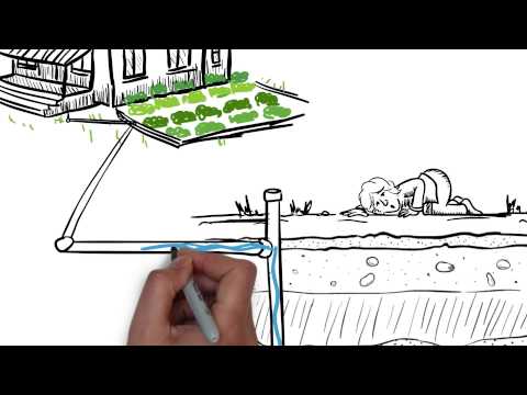
Water is always on the move. Surface water within lakes, rivers, streams and wetlands, as well as groundwater within aquifers underground, are part of a system that continually cycles water between the atmosphere, the surface of the earth and below ground. Groundwater, though often hidden, is a dynamic connector. It stitches together our environment and communities, flowing quietly beneath our feet yet playing a pivotal role in sustaining ecosystems and supporting our livelihoods and communities.

What is an aquifer?

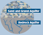
An aquifer is an underground layer of permeable rock, sand, or gravel that stores and transports groundwater. Aquifers can be defined as Bedrock Aquifers or Sand and Gravel Aquifers.

On this page, you can find information and resources about groundwater and groundwater sustainability in the region:

Subscribe to this page to receive notification of updates on the latest blog posts sharing stories, studies and events!


The Regional District of Nanaimo’s Drinking Water & Watershed Protection program's vision is for healthy, safe and resilient water resources in the region. Learn more about Drinking Water & Watershed Protection at dwwp.ca.

Welcome! This is a hub to connect residents in the Regional District of Nanaimo (RDN) with resources and information about their aquifers and groundwater sustainability.

Groundwater connects us - neighbours, communities and the environment.

The RDN is located on the central east coast of Vancouver Island and is located within the traditional territories of the Snuneymuxw, Snaw-naw-as and Qualicum First Nations. Communities within the region include the municipalities of Nanaimo, Lantzville, Parksville and Qualicum Beach, as well as seven unincorporated Electoral Areas. The RDN is home to over 170,000 people. About half of residents in our region rely on groundwater for their water supply. Municipalities, Regional District water services, improvement districts, small water system operators and private well owners use groundwater wells to access water from regional aquifers.

How groundwater connects us

Water is always on the move. Surface water within lakes, rivers, streams and wetlands, as well as groundwater within aquifers underground, are part of a system that continually cycles water between the atmosphere, the surface of the earth and below ground. Groundwater, though often hidden, is a dynamic connector. It stitches together our environment and communities, flowing quietly beneath our feet yet playing a pivotal role in sustaining ecosystems and supporting our livelihoods and communities.

What is an aquifer?

An aquifer is an underground layer of permeable rock, sand, or gravel that stores and transports groundwater. Aquifers can be defined as Bedrock Aquifers or Sand and Gravel Aquifers.

On this page, you can find information and resources about groundwater and groundwater sustainability in the region:

Subscribe to this page to receive notification of updates on the latest blog posts sharing stories, studies and events!


The Regional District of Nanaimo’s Drinking Water & Watershed Protection program's vision is for healthy, safe and resilient water resources in the region. Learn more about Drinking Water & Watershed Protection at dwwp.ca.

  • What’s Happening Beneath Our Feet: 2026 Groundwater Levels

    As we head into summer, a new regional groundwater report offers an important snapshot of the water below our feet, and what it means for our communities.

    Groundwater is a vital resource across the Regional District of Nanaimo. More than 40% of residents rely on it for drinking water, whether through municipal systems, improvement districts, First Nations systems, private utilities, or individual wells. It quietly supports homes, ecosystems, agriculture, and local economies, making its health essential to all of us.

    How groundwater is monitored

    Understanding groundwater isn’t simple. It’s hidden underground and varies from place to place. To track it, the RDN’s Drinking Water and Watershed Protection program works with both provincial partners and local volunteers.

    A network of monitoring wells across the region collects data on water levels in aquifers (the underground layers that store and move groundwater). This includes a Volunteer Observation Well Network, which expands coverage of the Provincial Observation Well Network, helping fill important data gaps and improve our understanding of long-term groundwater trends.

    Since 2020, the RDN has produced annual presummer groundwater analyses to support water planning and decision-making heading into the dry season. These reports look at both current conditions and trends over time.

    What the 2026 report shows

    This year’s analysis is the most comprehensive we’ve released yet. It includes data from 62 monitoring wells (30 RDN Volunteer Observation Wells and 32 Provincial Groundwater Observation Wells), and reporting from all 22 mapped aquifers in the region that currently have monitoring equipment installed to track groundwater levels.

    The overall picture is mixed. Across the region:

    • 11 aquifers are much below normal

    • 5 are below normal

    • 5 are within the normal range

    • 1 aquifer is much above normal

    In other words, most aquifers are starting the summer at lower-than-normal levels. While a few areas, such as parts of Oceanside, Parksville, and the Millstone Valley, are holding steady or even showing improvement, many others are under pressure. Aquifers underlying Nanoose, Qualicum, Cedar, French Creek, and Deep Bay are among those experiencing notably lower water levels than expected for this time of year.

    Recent weather patterns can be attributed to some of these lower levels, as the region has seen a drier-than-average winter, low snowpack (meaning less spring recharge), and a hotter-than-average spring. These conditions continue a broader pattern of drier trends observed over the past several years.

    Because groundwater is replenished slowly, through rainfall and snowmelt, these seasonal patterns can have lasting impacts.

    Why spring levels matter

    Groundwater levels in spring are an early warning sign for summer. If levels are already low heading into warmer months, and hot, dry weather continues, we can expect an increased demand for water (especially outdoors), greater stress on aquifers, and a higher risk of water shortages in some areas.

    Groundwater conditions vary widely across the region and aquifers differ depending on their geology (bedrock vs. sand and gravel, confined vs. unconfined), local rainfall patterns, and how much water is being used. Even within the same aquifer, conditions can vary significantly. This variability highlights the need for localized understanding and management, rather than a one-size-fits-all approach.

    What can we do?

    The most immediate and effective response is water conservation. Residents and businesses can help by:

    • Reducing outdoor water use

    • Fixing leaks promptly

    • Improving irrigation efficiency

    • Using rainwater where possible

    These small actions add up, especially during peak summer demand.

    Looking ahead and over the longer term, the report points to the need for broader strategies, including supporting groundwater recharge, expanding water storage, and improving water efficiency year-round. These efforts will help build resilience as climate patterns evolve.


    Groundwater may be out of sight, but it is central to daily life in the RDN. It connects our communities, supports our environment, and sustains our water supply.

    This year’s report is both a snapshot of current conditions and a call to action. By understanding what’s happening now, and taking steps to conserve and protect water, we can help ensure this critical resource remains healthy for years to come.

    As we head into summer, a new regional groundwater report offers an important snapshot of the water below our feet, and what it means for our communities.

    Groundwater is a vital resource across the Regional District of Nanaimo. More than 40% of residents rely on it for drinking water, whether through municipal systems, improvement districts, First Nations systems, private utilities, or individual wells. It quietly supports homes, ecosystems, agriculture, and local economies, making its health essential to all of us.

    How groundwater is monitored

    Understanding groundwater isn’t simple. It’s hidden underground and varies from place to place. To track it, the RDN’s Drinking Water and Watershed Protection program works with both provincial partners and local volunteers.

    A network of monitoring wells across the region collects data on water levels in aquifers (the underground layers that store and move groundwater). This includes a Volunteer Observation Well Network, which expands coverage of the Provincial Observation Well Network, helping fill important data gaps and improve our understanding of long-term groundwater trends.

    Since 2020, the RDN has produced annual presummer groundwater analyses to support water planning and decision-making heading into the dry season. These reports look at both current conditions and trends over time.

    What the 2026 report shows

    This year’s analysis is the most comprehensive we’ve released yet. It includes data from 62 monitoring wells (30 RDN Volunteer Observation Wells and 32 Provincial Groundwater Observation Wells), and reporting from all 22 mapped aquifers in the region that currently have monitoring equipment installed to track groundwater levels.

    The overall picture is mixed. Across the region:

    • 11 aquifers are much below normal

    • 5 are below normal

    • 5 are within the normal range

    • 1 aquifer is much above normal

    In other words, most aquifers are starting the summer at lower-than-normal levels. While a few areas, such as parts of Oceanside, Parksville, and the Millstone Valley, are holding steady or even showing improvement, many others are under pressure. Aquifers underlying Nanoose, Qualicum, Cedar, French Creek, and Deep Bay are among those experiencing notably lower water levels than expected for this time of year.

    Recent weather patterns can be attributed to some of these lower levels, as the region has seen a drier-than-average winter, low snowpack (meaning less spring recharge), and a hotter-than-average spring. These conditions continue a broader pattern of drier trends observed over the past several years.

    Because groundwater is replenished slowly, through rainfall and snowmelt, these seasonal patterns can have lasting impacts.

    Why spring levels matter

    Groundwater levels in spring are an early warning sign for summer. If levels are already low heading into warmer months, and hot, dry weather continues, we can expect an increased demand for water (especially outdoors), greater stress on aquifers, and a higher risk of water shortages in some areas.

    Groundwater conditions vary widely across the region and aquifers differ depending on their geology (bedrock vs. sand and gravel, confined vs. unconfined), local rainfall patterns, and how much water is being used. Even within the same aquifer, conditions can vary significantly. This variability highlights the need for localized understanding and management, rather than a one-size-fits-all approach.

    What can we do?

    The most immediate and effective response is water conservation. Residents and businesses can help by:

    • Reducing outdoor water use

    • Fixing leaks promptly

    • Improving irrigation efficiency

    • Using rainwater where possible

    These small actions add up, especially during peak summer demand.

    Looking ahead and over the longer term, the report points to the need for broader strategies, including supporting groundwater recharge, expanding water storage, and improving water efficiency year-round. These efforts will help build resilience as climate patterns evolve.


    Groundwater may be out of sight, but it is central to daily life in the RDN. It connects our communities, supports our environment, and sustains our water supply.

    This year’s report is both a snapshot of current conditions and a call to action. By understanding what’s happening now, and taking steps to conserve and protect water, we can help ensure this critical resource remains healthy for years to come.

  • We want to hear from you! Share how you are connected to groundwater for a chance to win

    CLOSED: This discussion has concluded.
    supporting image

    We want to hear from you! Share how you are connected to groundwater by participating in the Groundwater Connections Check-in where you'll get a chance to tell us your thoughts about the latest Groundwater Connections(External link) publication, and let us know what you are doing to protect and conserve groundwater and how we can support.

    By submitting a check-in form, you are helping us to better understand groundwater connections within our region and identify concerns or gaps that may be better supported through education, advocacy, or incentives to adopt groundwater stewardship practices (such as rebate programs).

    Submitted Forms may be entered into a draw to win a groundwater-friendly prize! Contest closes on September, 28, 2025.

    Find the Groundwater Connections Check-in tab on the home page or click here to submit a form now!

    We want to hear from you! Share how you are connected to groundwater by participating in the Groundwater Connections Check-in where you'll get a chance to tell us your thoughts about the latest Groundwater Connections(External link) publication, and let us know what you are doing to protect and conserve groundwater and how we can support.

    By submitting a check-in form, you are helping us to better understand groundwater connections within our region and identify concerns or gaps that may be better supported through education, advocacy, or incentives to adopt groundwater stewardship practices (such as rebate programs).

    Submitted Forms may be entered into a draw to win a groundwater-friendly prize! Contest closes on September, 28, 2025.

    Find the Groundwater Connections Check-in tab on the home page or click here to submit a form now!

  • Join us at an upcoming WellSmart Workshop - April 23 at 6:00pm at the Meadowood Hall
    supporting image


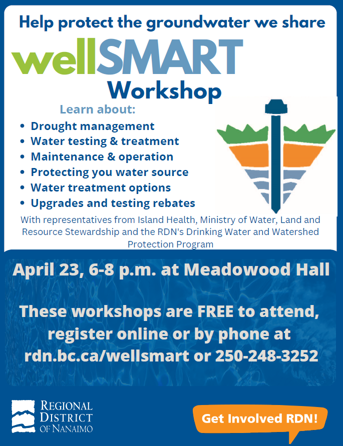
    April 23, 2025 at 6:00 p.m. at the Meadowood Hall

    Learn how to keep your well in safe running order. Led by the RDN's Drinking Water and Watershed Protection team, Island Health and the Province of BC to learn about:

    • Well maintenance and operation

    • Protecting your water source

    • Water testing and treatment

    • Water treatment options

    • Drought management

    This program is free!

    REGISTER HERE(External link)

    For more information, contact the Outreach Coordinator from the Drinking Water and Watershed Protection program at 1-877-607-4111 or watersmart@rdn.bc.ca(External link).


    April 23, 2025 at 6:00 p.m. at the Meadowood Hall

    Learn how to keep your well in safe running order. Led by the RDN's Drinking Water and Watershed Protection team, Island Health and the Province of BC to learn about:

    • Well maintenance and operation

    • Protecting your water source

    • Water testing and treatment

    • Water treatment options

    • Drought management

    This program is free!

    REGISTER HERE(External link)

    For more information, contact the Outreach Coordinator from the Drinking Water and Watershed Protection program at 1-877-607-4111 or watersmart@rdn.bc.ca(External link).


  • Our Regional Aquifers

    supporting image

    Bedrock aquifers and sand and gravel aquifers behave differently and it is important to monitor both. Bedrock aquifers in our region are generally lower yielding and more vulnerable to drought. In sand and gravel aquifers, productivity and seasonal impacts are variable – some are high yielding with lots of storage; others are more moderate yielding and more susceptible to overpumping and drought. Groundwater levels can vary across an aquifer depending on connectivity or the movement of water between aquifers or to a surface water source.

    The table attached shows water level trends in aquifers across the region. Of the 22 aquifers mapped and monitored in the region for groundwater levels in 2024, longer term trends indicate that:

    • five show increasing trends where groundwaters levels are observed to be closer to the surface,
    • four have stable water levels where no significant changes are seen,
    • five sites have declining trends where water levels are moving deeper, and
    • eight of the aquifers have variable results where long-term trends are inconsistent across the monitoring sites of an aquifer.

    Bedrock aquifers and sand and gravel aquifers behave differently and it is important to monitor both. Bedrock aquifers in our region are generally lower yielding and more vulnerable to drought. In sand and gravel aquifers, productivity and seasonal impacts are variable – some are high yielding with lots of storage; others are more moderate yielding and more susceptible to overpumping and drought. Groundwater levels can vary across an aquifer depending on connectivity or the movement of water between aquifers or to a surface water source.

    The table attached shows water level trends in aquifers across the region. Of the 22 aquifers mapped and monitored in the region for groundwater levels in 2024, longer term trends indicate that:

    • five show increasing trends where groundwaters levels are observed to be closer to the surface,
    • four have stable water levels where no significant changes are seen,
    • five sites have declining trends where water levels are moving deeper, and
    • eight of the aquifers have variable results where long-term trends are inconsistent across the monitoring sites of an aquifer.

  • The RDN's Volunteer Observation Wells (VOW) Network

    supporting image

    It is hard to manage what you don't measure - groundwater is one of those elusive things that is relatively hard to measure, but with the use of groundwater level monitoring equipment, water table depth measurements can be taken on an ongoing basis to understand what is going on underground. This provides a means to observe if water levels are changing over time, to get early warning if supply may be impacted and to better inform development that occurs in our region.

    The Drinking Water & Watershed Protection (DWWP) supported two initiatives as a part of this project, a collaboration to expand the B.C. Groundwater Observation Well Network within the region and the creation of the RDN Volunteer Observation Well (VOW) Network.

    To expand groundwater level data collection in our region beyond the provincial Observation Wells, 31 private well owners volunteered to have groundwater level monitoring equipment (pressure transducers) installed in their wells. The transducers record level data every 15 minutes; the data is downloaded by RDN staff four times per year. Fourteen of the loggers measure conductivity, to track saline (saltwater) intrusion potential in coastal wells. The monitoring of volunteer wells began in the spring of 2013, with expansions occurring in 2015, 2016 and 2017. It takes a minimum of five - ten years of data collection to begin to discern long-term trends from the information gathered. Since 2020, the RDN has supported annual pre-summer water level analysis reports. The figure below shows the sites included in analysis.

    Learn more about the Volunteer Observation Well (VOW) Network at rdn.bc.ca/groundwater-monitoring.


    It is hard to manage what you don't measure - groundwater is one of those elusive things that is relatively hard to measure, but with the use of groundwater level monitoring equipment, water table depth measurements can be taken on an ongoing basis to understand what is going on underground. This provides a means to observe if water levels are changing over time, to get early warning if supply may be impacted and to better inform development that occurs in our region.

    The Drinking Water & Watershed Protection (DWWP) supported two initiatives as a part of this project, a collaboration to expand the B.C. Groundwater Observation Well Network within the region and the creation of the RDN Volunteer Observation Well (VOW) Network.

    To expand groundwater level data collection in our region beyond the provincial Observation Wells, 31 private well owners volunteered to have groundwater level monitoring equipment (pressure transducers) installed in their wells. The transducers record level data every 15 minutes; the data is downloaded by RDN staff four times per year. Fourteen of the loggers measure conductivity, to track saline (saltwater) intrusion potential in coastal wells. The monitoring of volunteer wells began in the spring of 2013, with expansions occurring in 2015, 2016 and 2017. It takes a minimum of five - ten years of data collection to begin to discern long-term trends from the information gathered. Since 2020, the RDN has supported annual pre-summer water level analysis reports. The figure below shows the sites included in analysis.

    Learn more about the Volunteer Observation Well (VOW) Network at rdn.bc.ca/groundwater-monitoring.


  • The RDN's Drinking Water & Watershed Protection Program

    supporting image

    The Drinking Water and Watershed Protection (DWWP) program is a regional service tasked with helping to protect the region’s water resources. Through the DWWP program, we are working to: learn more about water in the region (Water Information & Science), use this information to make better land use decisions (Water-centric Planning and Policy Support) and help communities protect the environment (Water Awareness & Stewardship). All this is achieved through partnerships and collaboration!

    The RDN’s Drinking Water and Watershed Protection program goals are to facilitate and/or support regional initiatives that:

    • Protect, manage and restore ecosystems and the overall health and functioning of our watersheds and aquifers.
    • Safeguard and manage source waters to secure a sustainable drinking water supply.
    • Increase water-use efficiency and optimize infrastructure investments for water and wastewater systems.
    • Foster the enjoyment and protection of social, cultural, and recreational values and amenities in our watersheds to maintain well-being and quality of life.
    • Mitigate and better prepare for climate change impacts on the region’s water resource.

    Learn more about the RDN's Drinking Water & Watershed Protection program at rdn.bc.ca/drinking-water-and-watershed-protection.

    The Drinking Water and Watershed Protection (DWWP) program is a regional service tasked with helping to protect the region’s water resources. Through the DWWP program, we are working to: learn more about water in the region (Water Information & Science), use this information to make better land use decisions (Water-centric Planning and Policy Support) and help communities protect the environment (Water Awareness & Stewardship). All this is achieved through partnerships and collaboration!

    The RDN’s Drinking Water and Watershed Protection program goals are to facilitate and/or support regional initiatives that:

    • Protect, manage and restore ecosystems and the overall health and functioning of our watersheds and aquifers.
    • Safeguard and manage source waters to secure a sustainable drinking water supply.
    • Increase water-use efficiency and optimize infrastructure investments for water and wastewater systems.
    • Foster the enjoyment and protection of social, cultural, and recreational values and amenities in our watersheds to maintain well-being and quality of life.
    • Mitigate and better prepare for climate change impacts on the region’s water resource.

    Learn more about the RDN's Drinking Water & Watershed Protection program at rdn.bc.ca/drinking-water-and-watershed-protection.

Page last updated: 07 Jul 2026, 08:38 AM