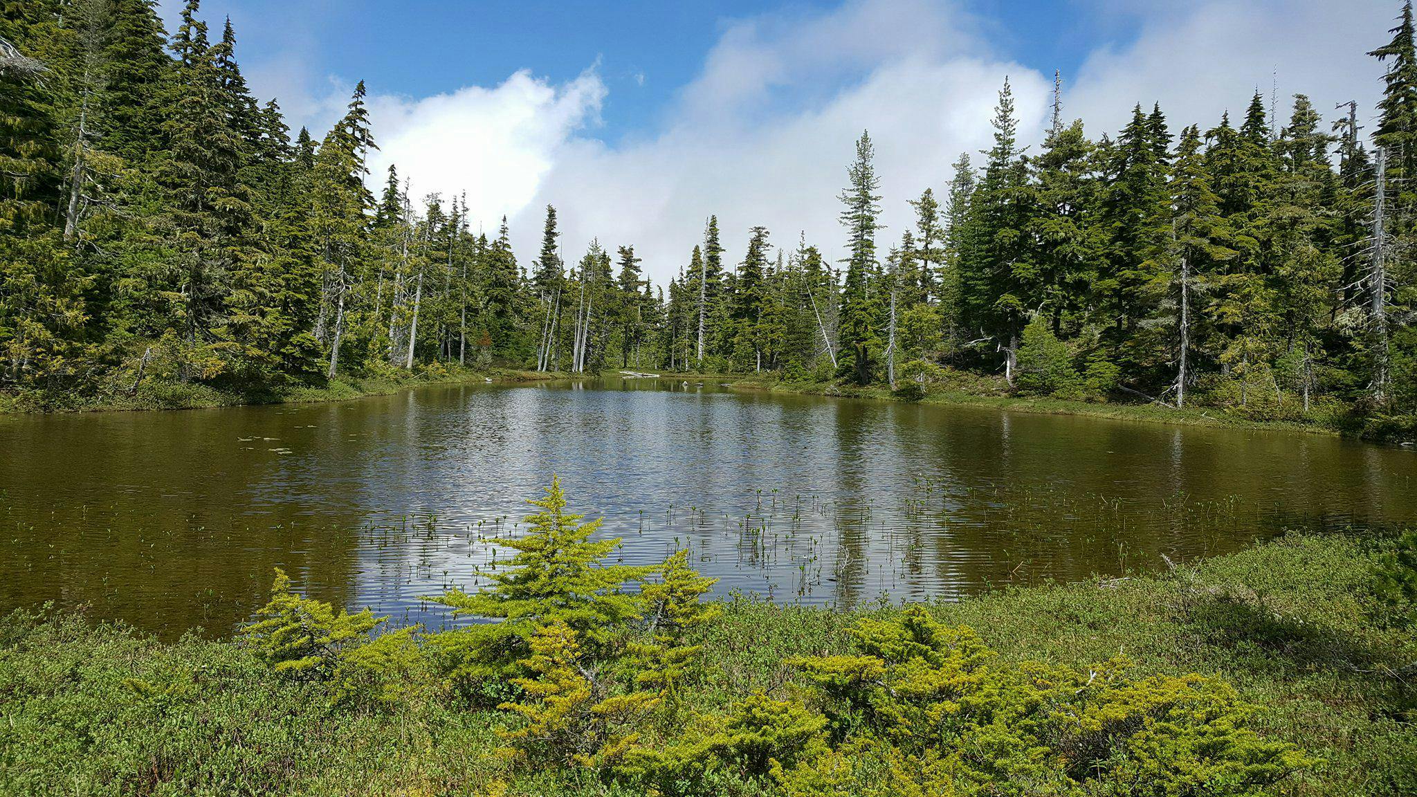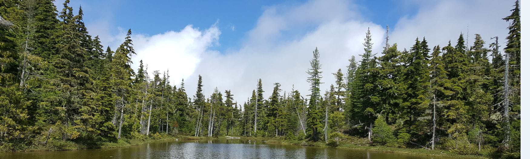
RDN Wetland Mapping
The Wetland Mapping and Monitoring project is a five-year research agreement that was created through a collaborative partnership with the Regional District of Nanaimo's (RDN) Drinking Water and Watershed protection (DWWP) program and Vancouver Island University (VIU). The project started in 2015 and was developed from recognition that there continues to be a lack of baseline data on wetlands in the region. Furthermore, there is limited data regarding where wetlands are situated, how they are classified, and what connection they have to groundwater recharge. This information is important for informing land use decisions in the region. Overall, research aims to inform policy and planning around wetlands in the region in order to better protect these important hydrologic features and ecosystems.
Student researchers follow the modified methods of the BC Wildlife Federation Wetlandkeepers program for mapping and classifying wetlands. Students also collect additional data relating to aquifers, geology, and land use. Students predominantly map wetlands during the summer and early fall field season. The data that students collect when in the field consists of: basic hydrological data (pH, turbidity, temperature), soil data, vegetation surveying, wetland perimeter and dimensions using a GPS, dominant and invasive species observations. Wetlands are further evaluated based on their overall wetland function while also considering influences from surrounding land uses, and visible physical features. Project guidance is provided from other partners, including: VIU faculty members from the Geography and Earth Science departments, and executive members of the Mid Vancouver Island Habitat Enhancement Society (MVIHES).
If you'd like to get involved with this research project or if you have a wetland on your property that you would like to volunteer to be mapped, feel free to pinpoint your wetland on the "Want to Volunteer your Wetland?" interactive map. For more information, we invite you to use the Q&A tab on this page or contact Haley Tomlin at the address listed at the bottom of this web page.
-
That’s a Wrap on 2023

2023 was another successful year for the Wetlands Mapping & Monitoring Project.
Thank you to all the volunteers who help to make this work possible! Over the past year we visited each of the six priority sites in April, July, October, and January, with support from stewardship groups, community members, and students from Vancouver Island University. Working with these volunteers not only leveraged the MABRRI team’s capacity to conduct our seasonal wetland surveys, but also provided some meaningful education and engagement opportunities.
During seasonal site visits, our team has continued to capture data that is actively contributing to long-term data collection. Building a dataset over multiple years allow us to identify seasonal variations in our wetlands over time, including hydrology, water quality, and dominant vegetation present. Check out the 2023 Summary Report in the document library for more details. The MABRRI team looks forward to our continued partnership with volunteers and to collaborating on monitoring these priority wetland sites throughout 2024!
This coming year brings exciting times, as we will begin to conduct a large-scale analysis on the data that we have collected from our six priority sites over the past four years. We look forward to the results of this analysis, and hope to identify trends in water movement, hydrology, and the unique characteristics of these diverse wetlands. The analysis of this data aims to provide insight into the possible connection between surface and groundwater in the regions surrounding these wetlands.
-
Junior Research Assistant Blog Post

As a Junior Research Assistant for MABRRI, I have happily had the opportunity to be part of the seasonal Wetland Monitoring project! This project has support from many citizen scientists in the community for some of the sites. It allows not only the ability for local members to get involved, but as well MABRRI staff to learn from the local community members.
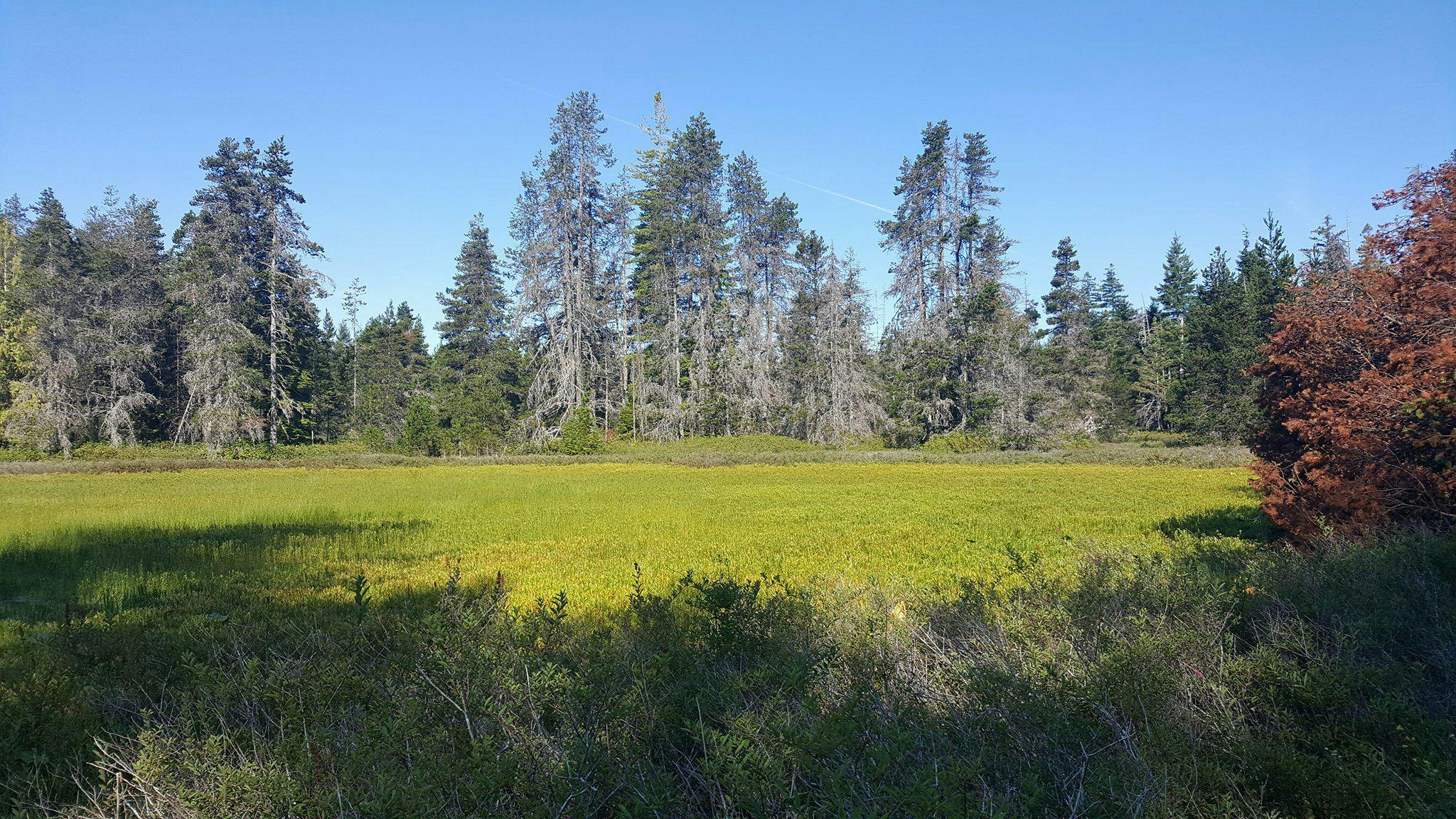
Once during every season, we visit each of the six sites to download the data from the instrumented sites as taken from the piezometers, rain gauge and trail cameras. These site visits allow us to practice finding site locations that are in more secluded areas and get comfortable using field equipment. The most interesting part of the visits to me, is that we take photos of each site in the same directions each time. This allows us to compare the areas seasonally, one example was how dry a site was in the summer and but in the winter the area was completely covered in water and had different surrounding vegetation. I look forward to this continuous monitoring project and learning about the long-term results as we collect more data over time.
By: Jocelyn Benji
-
A Successful First Year of Citizen Science Wetland Monitoring

In April 2021, MABRRI initiated the implementation of a citizen science network to support ongoing wetland monitoring in the RDN. We are happy to report that 14 citizen science volunteers from groups including the Arrowsmith Groundwater Alliance, Qualicum Beach Streamkeepers, and Quennell Lake Stewardship Society were trained to undertake seasonal monitoring fieldwork.
Collaboration with local citizen scientists has leveraged the capacity for this work to continue beyond the original 5-year research agreement between MABRRI and the RDN. Without our dedicated volunteers, the important data collection that was undertaken this year would not have been possible!
With now 3 years of seasonal observations for each of the 6 priority wetland sites, and 1 to 2 years of data for the 3 instrumented sites, we have been able to identify some best practices in our methods to implement moving forward. For the upcoming year, MABRRI and citizen science volunteers will continue seasonal monitoring and data collection for all 6 priority sites. It is intended to continue long-term monitoring to identify on-going changes these wetlands may face, solidify our methods of instrumentation data collection and analysis, and determine the role wetlands may play in groundwater recharge/discharge.
A summary report of the work completed in 2021 can be found here.
-
Citizen Science Wetland Monitoring in the RDN, April 2021

Following the final year of the RDN and MABRRI’s 5-year agreement, it was decided that longer-term monitoring of the instrumented wetlands would be important to carry forward – allowing for important data to be gathered from the equipment that was installed in 2019 and 2020. Moving forward, in collaboration with two volunteer groups, the Quennell Lake Watershed Stewardship Society (QLWSS) and the Arrowsmith Groundwater Alliance (AGWA), the 6 priority sites will be revisited each quarter (April, July, November, January) to continue identifying seasonal variations at the sites. Additionally, the volunteers from the AGWA will be assisting the MABRRI team with downloading the data at the three instrumented sites in the French Creek and Big Qualicum Water Regions. During each site visit, the data from the piezometers and rain gauge, as well as the photos from the trail cameras will be downloaded.
MABRRI has completed virtual training with volunteers via Zoom on April 12th, to be followed by site visits and data collection over the following week. The data collected will be slightly modified from the data collected over the past year – it will be minorly simplified, capturing the data that has been used to identify changes overtime, including the hydrology, water quality, and vegetation present in the wetland. Further, photo point monitoring will be implemented into the long-term monitoring, which involves taking photos at the exact same location, facing the same direction, during each visit. These photos will document the seasonality these wetlands experience.
The MABRRI team will continue to work with Alan Gilchrist, VIU Geography professor, to analyze and interpret the data collected. All of the data collected in 2021 will be compiled and shared with the RDN. Additionally, an overview of the data collected will be summarized and shared with the public and volunteers.
-
Wetland Mapping in the RDN, January 2021
The last year of the RDN and MABRRI’s 5-year agreement has now wrapped up. Over the last 5 years, the RDN and MABRRI have been working to reduce existing data gaps with regards to where wetlands are located, how they are classified, and what role they play in groundwater recharge across the RDN, working to understand the role they play locally.
In 2020, the MABRRI research team built on the work they completed in 2019. The team re-mapped each of the 6 priority sites they identified seasonally (January, April, July, and November 2020) in order to gain a better understanding of how they function throughout the year. With this information in hand, the 2019 Prioritizing Wetland Systems to Install Instrumentation in the RDN report was updated with the findings. In addition to the priority site visits, the priority sites document was updated to include methods and locations of the two new sets of instrumentation that were installed this year, as well as some of the initial findings from the data collected at all three pilot sites. It is hoped that with some further data collection and analysis we can really begin to understand the movement of water through these wetlands and what role they are playing in groundwater recharge. Further, as this was the last year of the research agreement, the MABRRI team has generated a Wetland Mapping & Monitoring in the Regional District of Nanaimo: 5 Year Summary Report, outlining the work completed; findings from the research; means of implementing best practices and policies locally; recommendations and costs pertaining to potential geophysical and cross-sectional analysis work that could be undertaken at local wetlands; and identified some potential next steps for this project, including the monitoring and maintenance of priority sites, specifically those with instrumentation. Finally, all of the data that was collected was uploaded into the RDN’s ArcGIS online map. All reporting and data collected will be publicly released early in 2021.
-
Final Year of the Wetland Mapping and Monitoring Project
This year marks the final year of the Wetland Mapping and Monitoring Project, and the team hopes to accomplish several goals:
Each of the six priority sites that were established last year will be re-mapped, including conducting a vegetation survey and collecting basic hydrologic data; this will provide the team with a more holistic idea of how these wetlands function. Each of the six selected sites will be visited seasonally and within a week of one another, ensuring there is little variation regarding weather between sites. The winter and spring visits already occurred in January 2020 and April 2020. The summer visit will occur in July 2020, followed by the fall visit in November 2020.
Additionally, the team will be conducting a primary data analysis of data collected from the instrumentation site that was established last year. Instrumentation was installed at one priority wetland in order to determine if the site is connected to the aquifer below and if it is, is it either recharging or discharging that aquifer. All data will be comparatively analyzed to determine if the instrumentation is effectively assessing the specified wetland and has a direct connection to groundwater recharge. Following the data analysis, the 2019 Prioritizing Wetland Systems to Install Instrumentation in the RDN report will be updated with the results. Further, depending on the success of the instrumentation and pending funding, the team hopes to install instrumentation at two more of the priority sites this year.
The team will be also be producing a 5-year summary report that will provide any findings over the last five years, as well as identify means of implementing policies into local wetlands, costs and recommendations pertaining to potential geophysical and cross-sectional work, and next steps for the project.
Lastly, the RDN and MABRRI will be working together to update the ArcGIS online map.
-
That's a Wrap on 2019

2019 was a very successful year for the Wetland Mapping and Monitoring Project! All four of our primary goals were accomplished. First, we completed mapping the wetlands in each of the seven water regions, including the Englishman River Water Region and the Gabriola Island Water Region. Reports that evaluate the mapped wetlands in these water regions were also completed, and can be found in the Document Library section of this webpage. Second, we established six priority sites to monitor in order to get a more holistic idea of how these wetlands function. The six priority sites were spread throughout theContinue reading
-
2019 Wetland Mapping Season Has Begun!

In April, Vancouver Island University students and MABRRI staff began year four of wetland mapping. There are four primary goals for the 2019-2020 year, including: 1) complete the mapping of wetlands in each of the seven water regions, including finishing up Englishman River Water Region and starting on the Gabriola Island Water Region; 2) establish six priority sites to monitor throughout the year in order to get a more holistic idea of how these wetlands function; 3) install instrumentation, including water level loggers and a rain gauge, at one priority wetland in order to determine its connection to groundwater recharge;Continue reading
-
Student Researchers Seek Wetlands to Map for the 2018 Research Season

Are you a community member that resides in the RDN? Are you interested in promoting and contributing to our understanding of wetlands and groundwater systems? Do you have a wetland that is located on your private property? If so, our team would love to collaborate in our regional initiative to increase freshwater sustainability.
If you are interested in volunteering your property and its associated wetland for mapping and classifying, please see our attachment that summarizes the project, wetland criteria, and how to get involved in 2018!!
-
Wetland Mapping Researchers and Geophysics Class at Vancouver Island University Use Ground-Penetrating Radar at Spider Lake

Did you know that Spider Lake is directly connected to its underlying aquifer?
Spider Lakes unique geologic environment was formed during the last glaciation period and is among one of the dynamic areas our research team has visited. On Friday, April 6th, our project lead and students from the VIU Earth Science department ran geophysical survey lines along Spider Lake. This part of the project was supported by VIU's Regional Initiative Fund which provided funding to Earth Science professor, Jerome-Etienne Lesemann, to investigate groundwater flow in partnership with our wetland mapping team.The purpose of using ground penetrating radar isContinue reading


Signup Banner

Document Library
-
 Priority Wetlands Reports
-
 Prioritizing Wetland Systems to Install Instrumentation in the Regional District of Nanaimo (2.81 MB) (pdf)
-
 Prioritizing Wetland Systems to Install Instrumentation in the Regional District of Nanaimo *Updated January 2021 (11.8 MB) (pdf)
-
Prioritizing Vulnerable Wetland Systems in the Regional District of Nanaimo (1.3 MB) (pdf)
-
-
Summary Reports
-
Wetland Classification and Geologic Assessment Reports